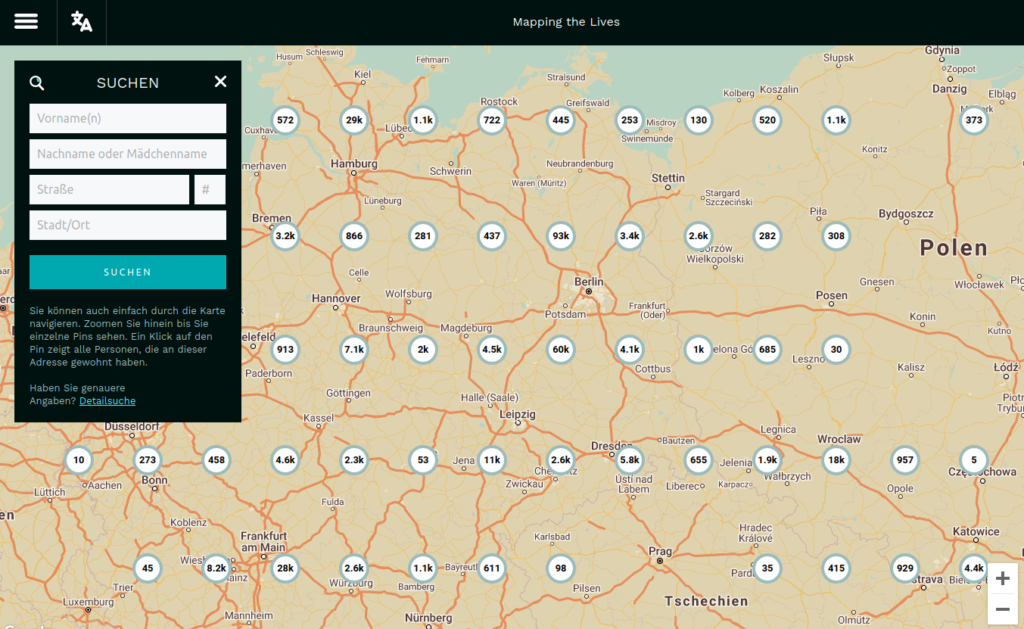
The interactive database with street maps of the persecuted in Europe 1933–1945
Mapping the Lives is a project dedicated to creating biographies, online maps and smartphone applications pinpointing the residential street addresses of all known victims of the Nazi Regime who were persecuted for reasons of race, religion, political views, resistance, sexual orientation, social orientation, and physical or mental incapacity. Personal biographies will eventually be expanded with biographies, photographs and links to family members, implementing crowd sourcing for additional material. The goal is to virtually recreate the neighborhoods of 1933-1945 Europe on a grass-roots level, which will reach the current residents of Europe in a way that no list of names in a typical memorial book possibly could: It gives the victims of the Nazis back a physical place, a “home,” and for many persecuted Europeans, a street address is the last remaining trace of their lives.
“Our goal is for you to be able to walk down any street in Europe and learn the Holocaust history of that specific place.”
The debut of Mapping the Lives incorporates a largely expanded and annotated version of the 1939 German Minority Census with more than 406,000 entries, adding information from the German Federal Archives’ List of Jewish Residents in the German Reich 1933-1945, (2012 Version). This includes places and dates of emigration, imprisonment, expulsion and deportation, dates of death, biographical details such as education, the ancestry of each person’s grandparents, a direct link to other family members, Jewish identity card numbers, nationalities, and direct links to the German Federal Archives Memorial book. The annotations show variations in name spellings and dates of birth etc., as well as if a person has two or more residences listed in the Census.
All of the entries are navigable via interactive maps showing the place(s) each person lived, allowing you to search complete streets and neighborhoods to see the biographies of the people who once lived there. Each marker on the map links directly people’s biography. Both the biographies and the maps will be additionally available via apps for the most commonly used mobile device platforms.
